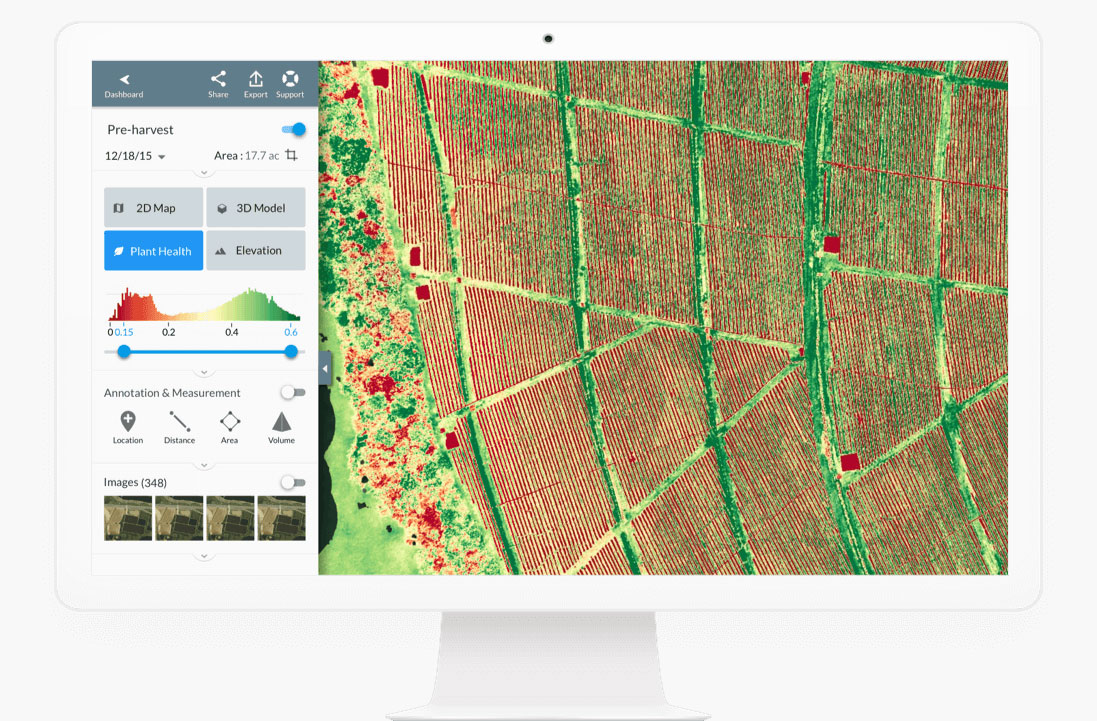
We can capture high-res images of your construction project and 3D maps that can be used to measure site conditions (stockpile volumes, distances, etc). With the help of 3rd party software, Above All Images can also monitor health of agriculture to determine if there are ares of your crops or property that need additional care.